
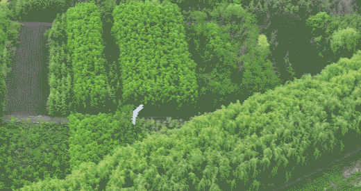
What Is a Drone UAV? Exploring the Role of VTOL UAVs in Surveying and Mapping
Introduction
If you’ve ever looked up at the sky and spotted a drone, you might have wondered: what exactly is a drone UAV and why is it so important today? Once limited to hobbyists and aerial photographers, drones—also known as UAVs (Unmanned Aerial Vehicles)—are now indispensable in surveying, mapping, agriculture, infrastructure inspection, and defense. Among the most innovative solutions is the dual fixed-wing VTOL UAV, a system that combines versatility with endurance.
What Is a Drone UAV?
Breaking Down the Concept
The term Drone UAV stands for an unmanned aerial vehicle—an aircraft that operates without a human pilot onboard. These machines can be remotely controlled or fly autonomously using onboard navigation systems. They are often equipped with cameras, LiDAR sensors, or multispectral imaging tools, enabling industries to collect precise data from the air.
Evolution of UAV Technology
The earliest UAVs were basic, lightweight, and short-range. As engineering advanced, so did UAV performance—leading to:
Multirotor UAVs: Excellent at hovering but limited in flight time.
Fixed-wing UAVs: Designed for long endurance but dependent on runways.
VTOL UAVs (Vertical Takeoff and Landing): Hybrid systems that merge vertical lift with fixed-wing efficiency.
Types of Drone UAVs
Multirotor UAVs
Common in consumer use (photography, short-distance flights).
Highly maneuverable but with limited endurance.
Fixed-Wing UAVs
Airplane-style design.
Ideal for long-range missions but need dedicated runways.
Dual Fixed-Wing VTOL UAVs
A hybrid design that takes off vertically like a helicopter.
Transitions into efficient fixed-wing flight for long-distance operations.
Why VTOL UAVs Are Transforming Surveying and Mapping
Long Endurance for Large-Scale Surveys
Mapping projects such as farmland monitoring, coastal surveys, and infrastructure analysis demand long flight times. Dual fixed-wing VTOL UAVs, like those from BOXIANG, provide up to 8 hours of endurance.
High Payload Capacity for Advanced Sensors
Surveying requires more than just photos—it involves LiDAR, EO, and multispectral imaging. BOXIANG UAVs support payloads of up to 50 kg, enabling diverse mission profiles.
Stability in Harsh Environments
BOXIANG VTOL UAVs withstand winds up to Level 8 Beaufort scale, ensuring reliable performance in adverse weather.
Company Background: CHANG CHUN CHANG GUANG BO XIANG UAV Co., Ltd.
Founded in 2009 within the Chinese Academy of Sciences UAV Division.
Restructured in 2021 as an innovation-driven enterprise, recognized as a “Specialized, Refined, Distinctive, and Innovative Enterprise” in Jilin Province.
Key Advantages of BOXIANG Dual Fixed-Wing VTOL UAVs
Compact, Portable Design – Reduced footprint, easy transport.
Safety & Reliability – GNSS anomaly handling, auto return-to-home.
Heavy Payloads + Long Endurance – Up to 2× the endurance and payload capacity compared with similar UAVs.
Multi-UAV Collaboration – Fleet operations with relay communication for complex missions.
Applications in Surveying and Mapping
Land Surveying
VTOL UAVs cut survey times from weeks to hours with centimeter-level accuracy.
Urban Planning & Smart Cities
Provide real-time 3D terrain and infrastructure models for planners.
Agriculture & Environmental Monitoring
Enable precision farming, soil health tracking, and deforestation monitoring.
Case Studies
Infrastructure Inspection: Power lines monitored safely without helicopters.
Disaster Response: Quick deployment after floods or earthquakes, delivering critical terrain data.
The Technology Powering BOXIANG UAVs
Dual-Wing Aerodynamics: Improves stability and energy efficiency.
Full-Vector Control Systems: Enhances maneuverability in dynamic conditions.
High-Precision RTK Positioning: Achieves 1 cm + 1 ppm accuracy for survey-grade mapping.
Future Outlook of VTOL UAVs in Mapping
Integration with AI & Big Data: Automated mapping, predictive insights, and real-time analytics.
Green Energy UAVs: Solar and hybrid-powered systems for sustainable long-endurance flights.
Conclusion
So, what is a drone UAV today? It is far more than a flying device—it is a critical tool for data-driven industries. With the rise of dual fixed-wing VTOL technology, UAVs now deliver unparalleled efficiency, accuracy, and adaptability. Companies like BOXIANG UAV are at the forefront, ensuring the future of mapping and surveying is faster, safer, and more precise.
FAQs
1. What makes dual fixed-wing VTOL UAVs unique?
They combine vertical takeoff with long fixed-wing endurance, eliminating runway dependence.
2. Why are VTOL UAVs superior for surveying compared to multirotors?
They cover larger areas, fly longer, and carry heavier payloads.
3. How accurate are BOXIANG UAVs in mapping?
With RTK positioning (1 cm + 1 ppm), they provide survey-grade accuracy.
4. Can VTOL UAVs handle strong winds?
Yes, BOXIANG models resist up to Level 8 Beaufort winds.
5. Which industries benefit from dual fixed-wing VTOL UAVs?
Surveying, mapping, agriculture, infrastructure inspection, logistics, and defense.