
UAV for Surveillance in Border Patrol Operations
Border surveillance requires more than flying a camera along a boundary. Patrol routes may cross mountains, deserts, rivers, farmland, coastal areas, forests, and remote regions where roads, communication networks, and launch infrastructure are limited.
A UAV for surveillance can provide an aerial layer between fixed observation systems and ground patrol teams. Equipped with visible-light, infrared, and laser-ranging payloads, a fixed-wing VTOL platform can support wide-area patrol, night observation, target positioning, incident assessment, and coordinated response.
However, effective border surveillance depends on the complete operating system rather than one aircraft specification. Operators must consider endurance with the actual payload, communication coverage, terrain masking, image quality, crew shifts, route overlap, emergency procedures, data security, and how aerial observations will be handed over to authorized ground teams.
What Is a UAV for Surveillance?
A UAV for surveillance is an unmanned aircraft configured to observe an area, collect visual or thermal information, and provide operators with actionable location and mission data.
In border patrol operations, surveillance may include:
Monitoring defined corridors and crossing points.
Observing remote roads, riverbanks, valleys, and mountain passes.
Detecting unusual activity during day or night.
Identifying and tracking objects or events of interest.
Measuring distance and estimating target position.
Relaying imagery and coordinates to authorized response teams.
Documenting incidents for later review.
Supporting patrol planning in difficult terrain.
The term does not describe one aircraft type. A multirotor, conventional fixed-wing aircraft, or fixed-wing VTOL UAV may all be used for surveillance. The correct platform depends on the route length, observation distance, terrain, hover requirement, launch area, communication system, and operating rules.
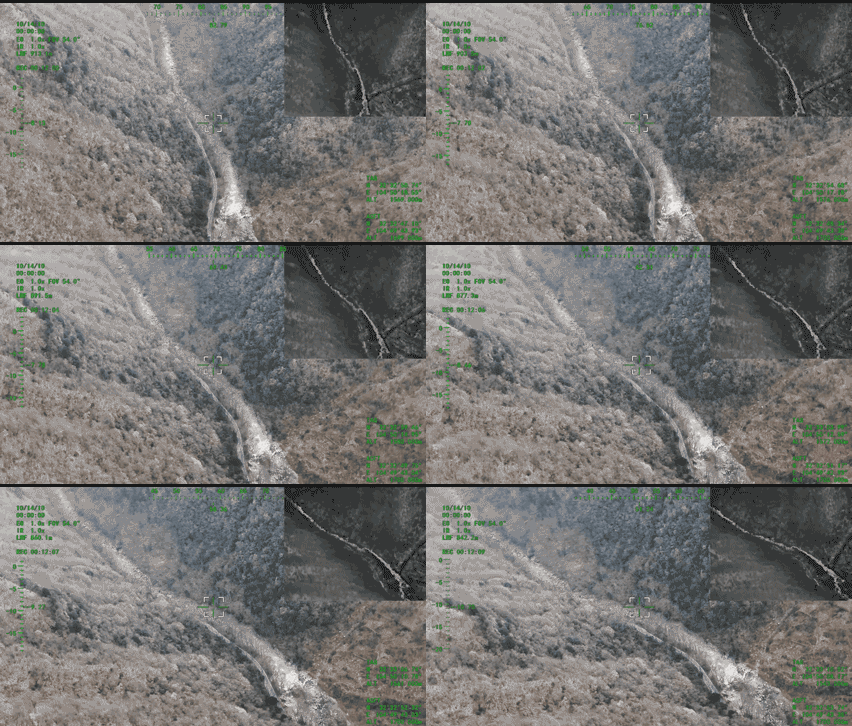
Why Border Surveillance Is a Distinct UAV Mission
Border patrol differs from local facility inspection because the operating area is usually long, uneven, and geographically dispersed.
A short inspection mission may focus on one building or tower. A border surveillance mission may need to follow an extended corridor, revisit observation points, maintain communication across changing terrain, and coordinate with several ground teams.
The main operational challenges include:
Wide Geographic Coverage
Border areas can extend across hundreds of kilometers. No single aircraft or observation point can provide continuous coverage of every location.
Operators therefore need to divide the border into practical patrol sectors and assign routes based on terrain, risk, access, airspace, communication coverage, and available response resources.
Difficult Launch and Recovery Conditions
Remote patrol teams may not have access to runways or prepared aviation facilities. Launch locations may be limited to roadsides, small clearings, patrol bases, or temporary staging areas.
Day-and-Night Observation
Visible-light cameras perform differently from infrared systems. Daytime identification may depend on lighting, haze, target size, and viewing angle, while nighttime detection depends heavily on thermal contrast and sensor performance.
Communication Blind Spots
Mountains, valleys, vegetation, buildings, and the curvature of the route can obstruct command links or payload video.
Advertised communication range measured under open conditions may not represent performance along a real border corridor.
Operational Continuity
Continuous surveillance cannot be created by endurance alone. It requires coordinated aircraft rotations, crew shifts, route overlap, battery or fuel turnaround, maintenance availability, and handover procedures.
Why Fixed-Wing VTOL Aircraft Suit Border Patrol
A fixed-wing VTOL UAV combines vertical takeoff and landing with efficient wing-borne cruise.
During takeoff and recovery, lifting rotors allow the aircraft to operate without a conventional runway. After transition, the wings provide efficient forward flight for longer patrol routes.
This combination can support border surveillance in several ways:
Deployment from compact or temporary field sites.
Efficient coverage of long corridors.
Reduced dependence on launch rails or parachute recovery.
Compatibility with stabilized EO/IR payloads.
Ability to revisit selected observation areas.
Flexible relocation between patrol sectors.
Support for remote, mountainous, desert, river, and coastal environments.
A fixed-wing VTOL aircraft is not automatically the best platform for every task. A multirotor may remain preferable when prolonged hovering or detailed observation of a small area is required. Fixed-wing VTOL becomes more valuable when the mission requires both runway-free deployment and efficient coverage of an extended route.
Border Environments and Mission Requirements
Mountain and Valley Patrol
Mountainous terrain creates wind changes, elevation differences, communication shadows, and limited emergency landing options.
Mission planners should verify:
Terrain elevation along the entire route.
Required service ceiling.
Wind and turbulence near ridgelines.
Line-of-sight between the aircraft and control station.
GNSS availability and anomaly procedures.
Alternate landing locations.
Reserve energy for unexpected rerouting.
A route that appears short on a flat map may require additional energy and communication planning when it crosses steep terrain.
Desert and Open-Area Surveillance
Desert patrols may provide long visual lines but introduce heat, dust, glare, limited landmarks, and large distances between support locations.
Important factors include operating temperature, payload cooling, dust protection, visibility, battery or fuel logistics, and the ability to recover the aircraft if the route changes.
River and Coastal Borders
Riverbanks and coastal routes can include moving vessels, changing water levels, reflective surfaces, fog, humidity, and limited landing areas.
Operators may require stabilized visible-light imaging, infrared observation, laser ranging, or mapping data depending on the mission.
Weather, corrosion protection, communication coverage, and safe recovery planning become especially important near water.
Forest and Remote Corridors
Forests can block direct observation, reduce communication performance, and limit emergency landing areas.
Thermal imaging may help detect temperature contrast through partial vegetation gaps, but it cannot see through dense obstacles in every condition. Operators should define realistic detection requirements and confirm them through representative field testing.
The Detect, Identify, Track, and Handoff Workflow
A practical border surveillance mission can be organized around four stages.
1. Detect
The operator first looks for activity or changes that differ from the expected environment.
Detection may use:
Wide-field visible-light imagery.
Infrared thermal imaging.
Predefined observation points.
Repeated patrol routes.
Automated alerts reviewed by trained operators.
The sensor, altitude, flight speed, weather, background temperature, target size, and viewing angle all affect detection performance.
2. Identify
After detecting something unusual, the operator may use optical zoom, a narrower field of view, or another sensor to collect more detail.
Identification should not be treated as guaranteed merely because a camera has a high zoom specification. Useful image detail also depends on stabilization, focus, atmospheric conditions, target distance, motion blur, and sensor resolution.
3. Track
Tracking provides continuity while operators assess the situation and coordinate an appropriate response.
The UAV may maintain observation by following a route, orbiting a permitted area, or handing coverage to another aircraft or observation system.
Tracking duration must be balanced against fuel or battery reserve, communication reliability, weather, airspace, and safe recovery requirements.
4. Handoff
The final objective is to transfer useful information to an authorized response team.
A complete handoff may include:
Time of observation.
Target or incident coordinates.
Measured or estimated distance.
Direction of movement.
Visible and infrared imagery.
Confidence level.
Relevant landmarks.
Recommended observation point.
Current aircraft and communication status.
Clear handoff procedures reduce ambiguity between UAV operators, fixed monitoring stations, command centers, and ground patrol teams.
Selecting EO, IR, and Laser-Ranging Payloads
The payload determines what the aircraft can observe and what information it can provide.
BOXIANG’s current payload catalog includes visible-light payloads, dual visible/infrared payloads, and tri-sensor configurations combining visible light, infrared imaging, and laser ranging. Payload compatibility depends on the aircraft model and final configuration.
Visible-Light EO Payloads
Visible-light cameras are suitable for daytime observation, route documentation, and visual confirmation.
Buyers should compare:
Sensor resolution.
True optical zoom.
Field of view.
Gimbal stabilization.
Low-light performance.
Target size at the intended distance.
Image quality while the aircraft is moving.
Digital or hybrid zoom can enlarge an image, but it does not replace the detail produced by suitable optics and adequate sensor resolution.
Infrared Payloads
Infrared imaging supports night observation and can help operators detect temperature differences that are difficult to see with a standard camera.
Thermal performance depends on:
Sensor resolution.
Lens and field of view.
Target temperature.
Background temperature.
Humidity, rain, fog, and atmospheric conditions.
Observation distance.
Viewing angle.
Time of day.
Infrared imagery should be interpreted by trained personnel and, where necessary, verified using other sensors or field observation.
Laser Ranging and Target Positioning
A laser rangefinder can provide measured distance to a selected object or location.
When combined with aircraft position, attitude, and gimbal orientation, ranging data may support more useful target positioning and ground-team handoff.
Operators should verify:
Minimum and maximum ranging distance.
Target reflectivity.
Atmospheric conditions.
Positioning accuracy.
Gimbal alignment.
Aircraft attitude accuracy.
Window and optical losses.
Required safety procedures.
BOXIANG publishes 120× and 240× EO/IR payload families, including tri-sensor options with laser-ranging functions. The current product page lists laser-ranging configurations from 5–1,500 meters and 50–3,000 meters, depending on payload model.
Planning Day-and-Night Patrol Operations
A day-and-night patrol program should not be treated as one continuous flight.
It is a repeated operating cycle involving aircraft, payloads, crews, communication systems, maintenance, and response teams.
Define Patrol Sectors
Divide the overall border area into sectors based on:
Terrain.
Access routes.
Observation priorities.
Communication coverage.
Airspace restrictions.
Launch and recovery locations.
Ground-response capability.
Available aircraft and crews.
Each sector should have a defined route, operating altitude, communication plan, alternate landing locations, and response procedure.
Use Standardized Route Templates
Repeatable routes help operators compare current observations with previous patrols.
A route template may define:
Start and end points.
Patrol altitude.
Observation checkpoints.
Speed changes.
Camera orientation.
Communication checks.
Handover points.
Emergency recovery areas.
Routes should still be adjusted when weather, temporary restrictions, terrain hazards, or operational priorities change.
Create Overlapping Coverage
When one aircraft leaves a sector before another arrives, a surveillance gap may occur.
Coverage overlap can be created through:
Overlapping flight schedules.
Adjacent patrol sectors.
Multiple aircraft.
Fixed observation systems.
Ground patrol coordination.
Communication relays.
The required overlap depends on the importance of the sector, aircraft turnaround time, response capability, and acceptable observation gap.
Plan Crew Shifts
Continuous operations require more than pilots.
A surveillance team may include:
Remote pilots.
Payload operators.
Mission commanders.
Data or intelligence reviewers.
Maintenance personnel.
Communication specialists.
Ground-response coordinators.
Shift planning should account for workload, fatigue, handover quality, training, and local operating requirements.
Communication Planning for Border Surveillance
Communication is one of the most important limitations in long-range surveillance.
Three different links may be involved:
Aircraft command and control.
Telemetry and system status.
Payload video or mission data.
These links may have different ranges, frequencies, bandwidths, latency, and failure behavior.
Why Published Range Is Not Enough
A maximum range figure is usually measured under specified conditions. Actual performance may be reduced by:
Mountains and ridgelines.
Valleys and depressions.
Vegetation.
Buildings.
Antenna height and orientation.
Radio interference.
Weather.
Aircraft attitude.
Ground-station location.
Payload bandwidth.
Operators should perform route-specific communication testing rather than assuming that one advertised distance applies everywhere.
Communication Redundancy
Depending on the mission and local authorization, redundancy may include:
Primary and backup RF links.
Cellular connectivity.
Relay aircraft or ground repeaters.
Satellite communication.
Local recording if live video is interrupted.
Predefined lost-link procedures.
Redundancy should be designed around the actual route and mission risk, not added as a generic feature.
Lost-Link Planning
The aircraft must have a defined response if communication is degraded or lost.
Possible responses may include:
Continue to a predefined communication point.
Return along an approved route.
Return to the launch site.
Proceed to an alternate landing location.
Hold temporarily within a defined area.
Land under predefined conditions.
The appropriate behavior depends on terrain, airspace, fuel or battery state, population exposure, and operating approval.
Measuring Real Endurance and Patrol Coverage
Maximum endurance does not equal continuous surveillance time.
Usable mission time is reduced by:
Vertical takeoff and landing.
Transition between flight modes.
Travel to and from the patrol sector.
Payload weight and power demand.
Headwind.
Altitude and temperature.
Loitering or orbiting.
Communication rerouting.
Required reserve.
Alternate landing requirements.
A more useful calculation is:
usable observation time = total validated endurance − outbound travel − return travel − reserve − operational contingency
The aircraft should be tested with the intended payload and representative route conditions.
BOXIANG’s current electric fixed-wing VTOL product range includes portable and larger platforms with model-specific differences in payload capacity, endurance, cruise speed, wind limits, and communication range. The hybrid product range is intended for missions requiring longer flight time, heavier payloads, or extended remote-area operations.
Data Management and Ground-Team Handoff
A surveillance program should define how data moves from the aircraft to the people responsible for making decisions.
Live Mission Data
During flight, operators may need:
Aircraft location.
Route status.
Altitude and speed.
Link quality.
Battery or fuel state.
Payload orientation.
Live visible-light video.
Live thermal imagery.
Laser-ranging data.
Target coordinates.
The interface should prioritize information that supports immediate decisions without overwhelming the operator.
Incident Records
When an event is recorded, the system should preserve:
Date and time.
Coordinates.
Sensor used.
Relevant image or video segment.
Operator notes.
Confidence or verification status.
Handoff recipient.
Actions taken.
Final disposition where appropriate.
Standardized records make it easier to review events, compare patrols, train operators, and audit system use.
Data Security
Border surveillance data may contain sensitive location, infrastructure, personnel, or operational information.
The operating organization should define:
Who can view live feeds.
Who can access stored data.
Encryption requirements.
Retention periods.
Export permissions.
Backup procedures.
Incident logging.
Cybersecurity responsibilities.
Rules for sharing information with other agencies.
Safety, Privacy, and Responsible Operation
A UAV for surveillance should operate under applicable aviation, privacy, data-protection, and public-safety requirements.
A responsible program should include:
Defined mission authority.
Approved operating areas.
Qualified personnel.
Airspace coordination.
Clear data-collection purposes.
Access and retention controls.
Procedures for incidental capture of people or private property.
Human review of automated detections.
Documented escalation and response processes.
Regular safety and compliance reviews.
Automated detection can assist operators, but it should not replace human judgment, verification, or legally required decision-making procedures.
What to Verify Before Selecting a Border Surveillance UAV
BOXIANG UAV Solutions for Border Surveillance
BOXIANG develops electric and hybrid fixed-wing VTOL UAV platforms for long-range patrol, infrastructure inspection, emergency response, mapping, and remote-area operations.
Border surveillance configurations may include:
Stabilized visible-light EO cameras.
Dual EO/IR payloads.
Tri-sensor payloads with laser ranging.
Communication-relay equipment.
Portable or vehicle-based ground control stations.
Mission-specific data links.
Electric or hybrid fixed-wing VTOL airframes.
Relevant product pages include:
The final platform should be selected from the actual patrol sector, payload, observation distance, terrain, weather, communication architecture, crew plan, and operating authorization.
Building a Border Surveillance Program
A new program can reduce operational risk by expanding in stages.
Stage 1: Define the Mission
Identify the specific operational question.
Examples include:
Which corridor requires scheduled observation?
What type of activity must be detected?
At what distance must operators identify relevant details?
Is night detection required?
How quickly must information reach ground teams?
What observation gaps are acceptable?
Stage 2: Select a Representative Pilot Sector
Choose an area that includes realistic terrain, communication conditions, target distances, launch constraints, and response requirements.
Stage 3: Validate the Complete Configuration
Test the aircraft with the intended payload, communication system, route, reserve policy, crew workflow, and data-delivery process.
The airframe and payload should not be validated separately and assumed to perform identically after integration.
Stage 4: Measure Operational Results
Useful evaluation metrics may include:
Area or corridor covered.
Usable observation time.
Detection and identification quality.
Communication availability.
Number and duration of link interruptions.
Target-coordinate accuracy.
Handoff time.
Aircraft turnaround time.
Maintenance requirements.
Number of repeat flights.
Crew workload.
Stage 5: Standardize Procedures
Create documented procedures for route planning, launch-site assessment, payload settings, communication checks, target handoff, lost link, emergency recovery, data storage, maintenance, and shift changes.
Stage 6: Expand by Sector Type
After the workflow is proven, expand to sectors with similar terrain and communication conditions. Mountain, desert, river, coastal, and populated areas should be evaluated separately when their operating conditions differ significantly.
Frequently Asked Questions
What is the main advantage of a fixed-wing VTOL UAV for border patrol?
It combines runway-free takeoff and landing with efficient forward flight. This can be useful when patrol routes are long but launch and recovery sites are limited.
Can one UAV provide continuous 24/7 surveillance?
Normally, no. Continuous coverage requires multiple sorties and may require several aircraft, crew shifts, route overlap, maintenance planning, and support from fixed sensors or ground patrol teams.
Which payload is best for day-and-night surveillance?
A dual EO/IR payload is commonly used because visible-light imaging supports daytime observation while infrared imaging supports detection in low-light or nighttime conditions. A tri-sensor payload can add laser ranging for distance measurement and target positioning.
Is optical zoom enough to identify a distant target?
Not by itself. Identification also depends on target size, sensor resolution, stabilization, atmosphere, lighting, observation angle, motion blur, and actual optical—not only digital—magnification.
What is the difference between flight range and communication range?
Flight range is determined by aircraft endurance and mission conditions. Communication range describes the performance of the command, telemetry, or payload-data link. These values are different and should be evaluated separately.
How should communication blind spots be handled?
Operators should test the actual route, identify terrain masking, reposition ground stations where permitted, define communication checkpoints, use appropriate redundancy, and establish safe lost-link procedures.
Why is laser ranging useful for border patrol?
Laser ranging can provide measured distance to a selected object or location. When integrated with aircraft and gimbal positioning, it can support more precise target coordinates and clearer handoff to authorized ground teams.
What information should be sent to a ground patrol team?
A useful handoff may include coordinates, distance, direction of movement, time, visible or thermal imagery, nearby landmarks, and the confidence or verification status of the observation.
Should border surveillance UAVs use automated detection?
Automated tools may help operators review large amounts of video, but alerts should be checked by trained personnel. Operational decisions should follow applicable laws, policies, and human-review requirements.
Conclusion
A UAV for surveillance can support border patrol by combining wide-area observation, runway-free deployment, EO/IR imaging, laser ranging, and structured coordination with ground teams.
The most effective system is not simply the aircraft with the longest endurance or highest zoom specification. It is the complete configuration that provides usable imagery, reliable communication, sufficient reserve, clear target handoff, responsible data management, and repeatable day-and-night operations.
By defining the mission first, testing the complete aircraft-and-payload configuration, planning for communication blind spots, and building overlapping patrol and crew schedules, operators can develop a more reliable border surveillance program for mountainous, desert, river, coastal, and remote environments.
Discuss Your Border Surveillance Mission
Provide the patrol-sector length, terrain, required observation distance, day-and-night payload requirements, communication conditions, data output, deployment constraints, and operating environment.
BOXIANG can recommend an electric or hybrid fixed-wing VTOL configuration based on the actual surveillance mission.